Global Map on the Website
This article is incomplete & needs to be reviewed. You can help by creating a pull request.
The osmand.net/map site is currently being developed and tested.
Therefore, the layout and operation of some functions on the site may be different from those described in this article.
We created the Discussion theme on our GitHub so you can leave feedback there.
Overview
The OsmAnd web map is a global map based on OpenStreetMap (OSM) data. It allows users to view their own data, such as tracks and favorites, create navigation routes for any profile, and access additional features like weather, public GPX tracks, POIs, and Wikimedia images. Explore and customize your data experience directly in your browser.
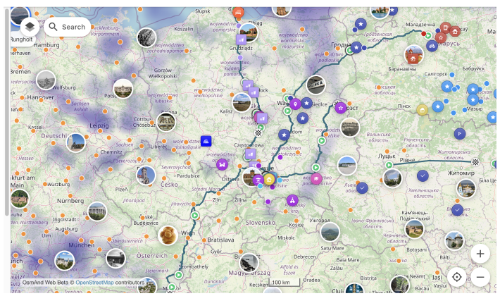
Map Context Menu
For opening it right click anywhere on the map. This menu includes the following actions:
- Where am I – Quickly find your current location on the map. This feature displays the nearest addresses to the selected point on the map.
- Open weather – Access the Weather menu to view weather details.
- Create new route – Opens the Plan a route tool with the selected location as the starting or destination point.
- Add Favorite – Allows you to create and save a favorite at any point on the map for easy access.
- Directions from – Sets the selected point as the starting location for navigation.
- Directions to – Sets the selected point as the destination for navigation.
- Copy coordinates – Copies the coordinates of the selected point for external use.
- Add pin – Places a pin to mark a location on the map. (Example)
- Show regions – Displays the regions associated with the selected location.

Weather on the Web
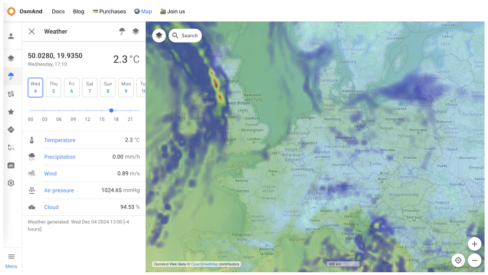
The OsmAnd Web provides weather information from two forecast sources:
- GFS (default)
- ECMWF
To switch between these forecast sources, click the umbrella button in the Weather menu.
Features of the weather menu:
Current Weather Data: Displays your coordinates along with the following data:
- Temperature.
- Precipitation.
- Wind.
- Air Pressure.
- Cloud Cover.
Time Adjustment: Modify the date and time using the time tool in the Weather menu to view weather for a specific moment.
Weather layers on the map:
Use the layers button to select and enable weather layers such as:
- Temperature.
- Pressure.
- Wind.
- Cloud Cover.
- Precipitation.
Viewing forecasts:
- Weather forecasts are available for the 7-day forecast.
- Forecast updates are provided in 3-hour steps for detailed insights.
To access or customize these features, use the menus on the left or right side of the interface.
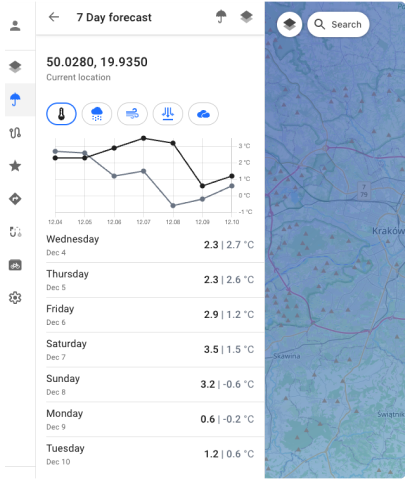
7-Day Forecast:
Click on the forecast data in the menu to view the 7-day forecast for your location. The forecast is available in:
Graph format
List format
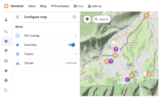
Configure Map Menu
The Configure Map menu allows you to manage the display settings for map data, such as POI layers, Favorites, tracks, and terrain. Please log in to your OsmAnd account to use this menu section.
To open this menu, click the button in the top left corner or access it through the Menu.
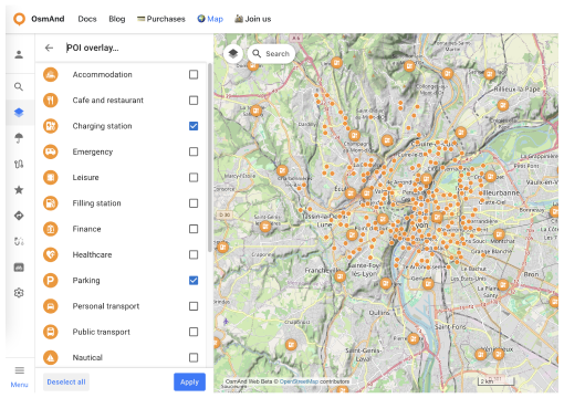
- POI overlay.... Allows you to choose and show needed POI categories on the map.
- Favorites. Toggle the display of favorites on the map.
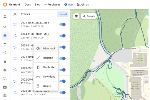
- Tracks. Contains GPX tracks visible on the map.
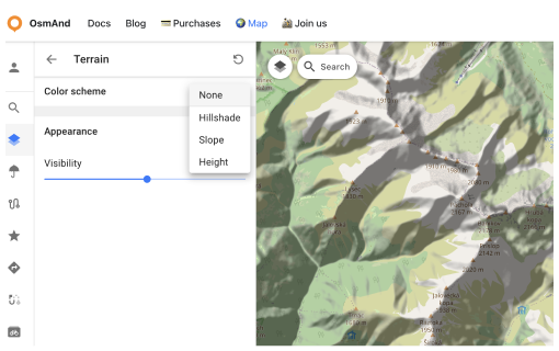
- Terrain. Enable or disable the terrain color scheme on the map.
POI overlay section
To show POIs on the map:
Configure map menu → POI overlay.... Here, you can choose categories to display on the map.
Alternatively, you can use the Search section to find the desired place.
Favorites Section
With one click, you can toggle favorites on or off on the map. However, only favorites with Show on map enabled will be displayed.
Tracks section
This section contains a list of the user's GPX tracks visible on the map and Recently Visible tracks.
- You can toggle tracks on or off directly.
- Switch tracks on or off from the Recently Visible list.
Each track has a Context Menu (accessible via the ⋮ button) with the following commands:
- Hide track: Hides the currently visible track from the map.
- Make track visible: Displays a track from the Recently Visible list on the map.
- Rename: Allows you to rename the track for easier identification.
- Duplicate: Creates a copy of the track.
- Download: Saves the track to your local device.
- Delete: Removes the track permanently from the list.
Terrain section
The Terrain section is a paid feature 
In this section, you can:
- Choose a color scheme for terrain:
- Hillshade
- Slope
- Height
- Adjust the visibility of the selected terrain layer from 0% to 100%.
URL Schemes
For easy use of the OsmAnd web service (and application), you can take advantage of direct links. These are special URLs that allow you to transfer location data and include details about pins, tracks, weather, and more.
These URLs can be copied and shared using any medium supported by your device and are compatible with both the Android and iOS versions of OsmAnd.
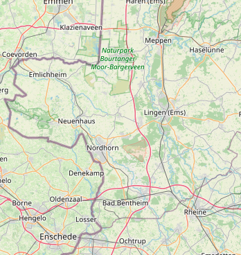
URL with a pin on the map:
https://osmand.net/map/?pin=52.491143,7.116394#9/52.3924/6.3116
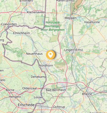
URL without a pin on the map:
https://osmand.net/map/#9/52.3924/6.3116
URL with navigation:
osmand.net/map/navigate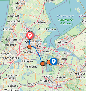
Depending on the specified parameters, URL strings can contain:
- latitude: latitude value as a number.
- longitude: longitude value as a number.
- start-finish: coordinates for navigation.
- profile: navigation profile (e.g., car, bike).
- zoom: zoom level.
- Weather –
osmand.net/map/weather
For example, you can directly access the weather page with specified coordinates:
https://osmand.net/map/weather/#9/52.2394/21.0362
Account –
osmand.net/map/accountConfigure Map –
osmand.net/map/configure/Tracks –
osmand.net/map/mydata/tracksFavorites –
osmand.net/map/mydata/favoritesSettings –
osmand.net/map/settingsPlan a Route -
osmand.net/map/planDirect link to the current Explore page -
osmand.net/map/search
This article was last updated in January 2025